


Fernbank-Wilson, Lamar County, Alabama
About
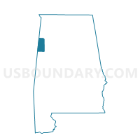
Outline

Summary
| Unique Area Identifier | 522181 |
| Name | Fernbank-Wilson |
| County | Lamar County |
| State | Alabama |
| Area (square miles) | 36.95 |
| Land Area (square miles) | 36.93 |
| Water Area (square miles) | 0.02 |
| % of Land Area | 99.96 |
| % of Water Area | 0.04 |
| Latitude of the Internal Point | 33.59696980 |
| Longtitude of the Internal Point | -88.17031930 |
Maps


Graphs
Select a template below for downloading or customizing gragh for Fernbank-Wilson, Lamar County, Alabama


Neighbors
Neighoring Voting District (by Name) Neighboring Voting District on the Map
- Millport-Library, Lamar County, AL
- Mt. Olive-Guin, Lamar County, AL
- Mt. Pleasant-Curry, Lamar County, AL
- Rural Hill B Voting District, Lowndes County, MS
- Star, Lamar County, AL
- Steens A Voting District, Lowndes County, MS
- Trull, Lamar County, AL
- Vails, Lamar County, AL
Top 10 Neighboring County Subdivision (by Population) Neighboring County Subdivision on the Map
- District 1, Lowndes County, MS (12,934)
- District 3, Lowndes County, MS (12,419)
- Millport CCD, Lamar County, AL (4,162)